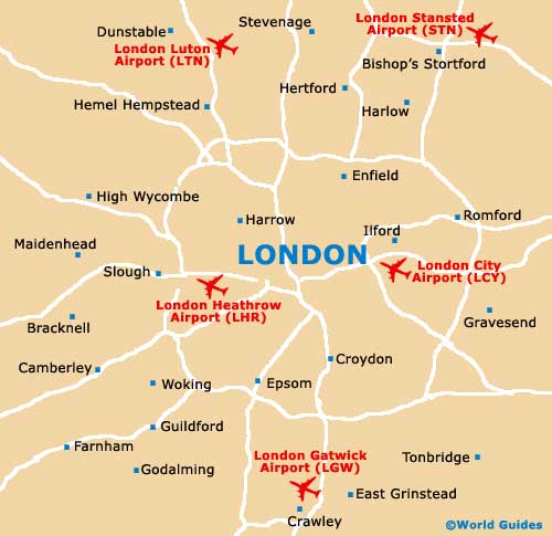
London Gatwick Airport (LGW)
City Orientation and Maps
(London, England)
One of the world's most famous capital cities, London is situated on the south-eastern side of England and contains many spectacular sights and historic buildings, such as the Houses of Parliament. Many noteworthy cities, towns and suburbs are sited close to London and include Romford and Dagenham to the east, Hemel Hempstead and Broxbourne to the north, and Reading and Newbury to the west. To the south of the city, Horley and Crawley are nearby, being located either side of London Gatwick Airport (LGW), close to the M23 and East Grinstead.
Encircling the whole of London, the M25 is a well-known motorway, providing easy access to many of the city's most prominent suburban districts and nearby locations. However, those wishing to travel around the city should consider London's sprawling network of underground trains, which is simply referred to locally as the 'tube'.
London Gatwick Airport (LGW) Maps: Important City Districts
The whole city is split into zoned areas, with Zone 1 sited in the very heart of London. Regions within Zone 1 include Victoria, St. James's Park, Westminster, Holborn, Bank and Liverpool Street - next to the city's acclaimed financial 'square mile' and close to the Bank of England. Zone 6 is the furthest outer region, to the north of Gatwick Airport.
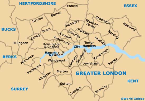
London is also divided into numerous prominent districts, where many top tourist attractions reside. These include Richmond, Kingston upon Thames, Fulham, Greenwich, Lewisham, Camden Town, Islington, Hammersmith and Kensington.
England Map

Greater London Map
London Map